A gravel day in eastern Algarve: Vila Real de Santo António, Castro Marim, salt marshes and coastal dunes
A gravel day in eastern Algarve: from the Guadiana to the dunes, from the Pombaline city to the salt marshes
Discover the authentic Sotavento algarvio through Vila Real de Santo António, Castro Marim, salt marshes and coastal dunes for a complete gravel exploration between Portugal and Spain
Published on Thursday, March 27, 2026
Eastern Algarve, known locally as the Sotavento algarvio, represents a profoundly different cycling territory from the dramatic rocky western coasts. Indeed, here between the Guadiana river mouth marking the natural border with Spain and the vast Atlantic dune systems, you'll find horizontal landscapes composed of compartmentalised waters, geometric salt flats, and coastal pine forests stabilising fragile dunes.
This gravel day explores this unique territory starting from Vila Real de Santo António, an 18th-century Pombaline city designed with geometric precision. The route traverses protected salt marshes, historic fortified villages, and Ramsar-classified wetlands before returning through the spectacular Mata Nacional dunaire forest. This represents Algarve gravel in its most horizontal, contemplative, and culturally rich expression.
At Baroudeur Cycling, we explore these lesser-known terrains offering authentic gravel experiences far from typical tourist circuits. Discover our Algarve gravel tour and our region's essential routes.
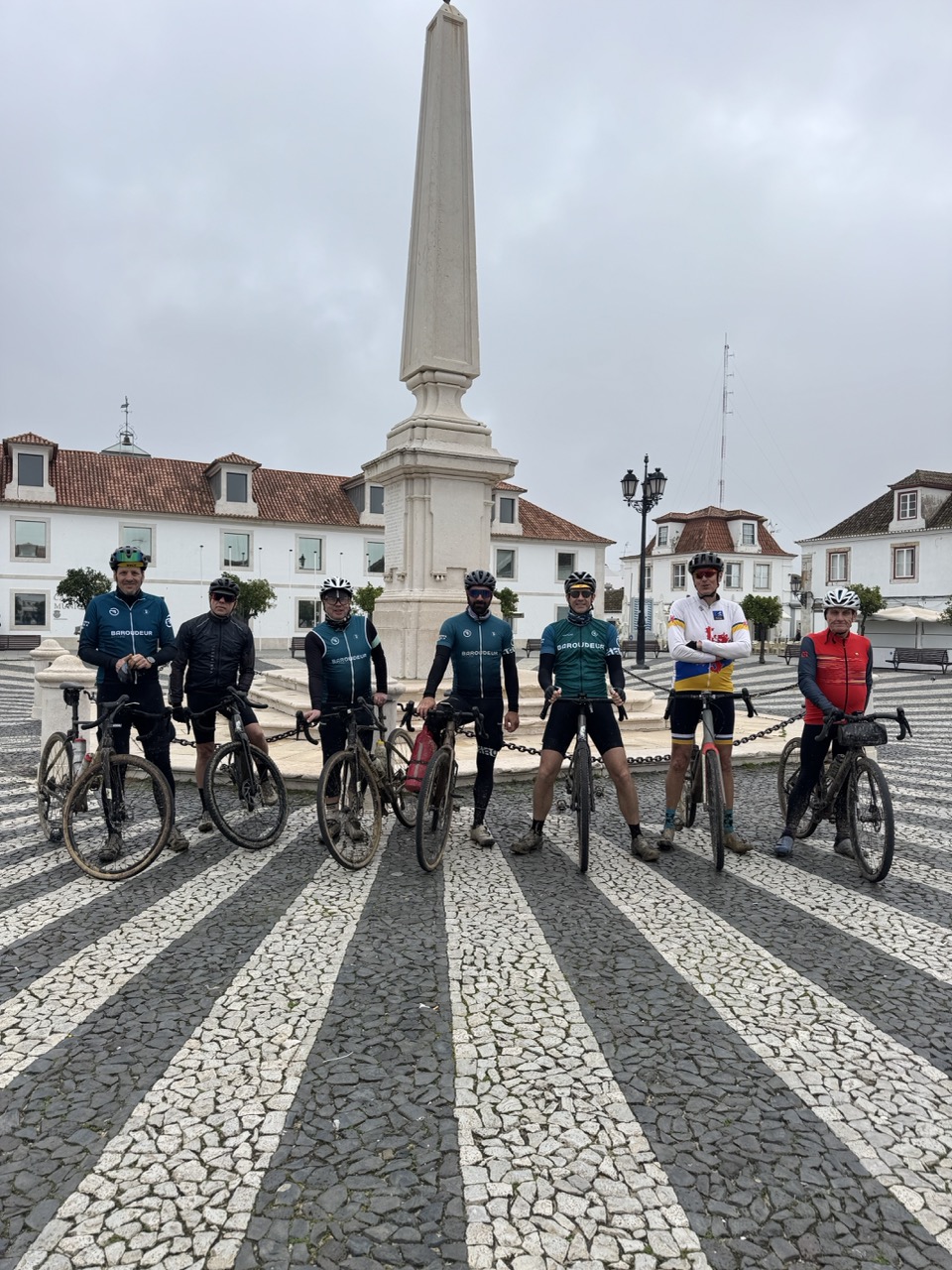
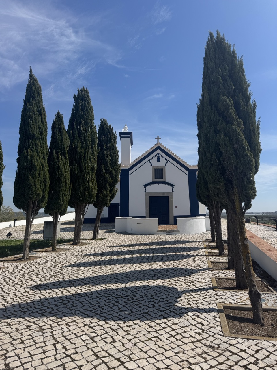
Starting point: Praça Marquês de Pombal, the grid-plan city setting the tempo
Vila Real de Santo António, Pombaline urbanism in southeastern Algarve
You begin at the exact centre of Vila Real de Santo António, on Praça Marquês de Pombal. This perfectly structured square serves as the focal point where historic centre streets converge following the regular grid typical of 18th-century Pombaline urban planning. The central obelisk and surrounding major buildings (church, town hall, administrative edifices) clearly demonstrate a city planned with geometric precision as a strategic border settlement.
Founded during the 18th century as a frontier town controlling the strategic Guadiana estuary, Vila Real de Santo António displays this distinctive urban geometry that makes cycling departures particularly pleasant. You clip in, you roll, and the route reads intuitively through this clear, rational spatial organisation.
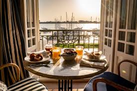
Ideal logistical base: The Bordoy Grand House Algarve positions itself strategically at the perfect location.
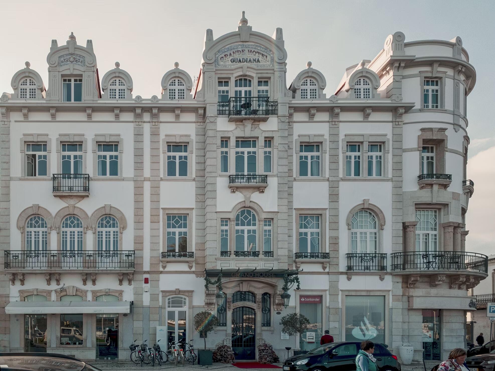
This Belle Époque establishment sits within the historic town facing the Guadiana, providing an ideal base when you want a central departure and return point for gravel rides exploring eastern Algarve whilst simultaneously enjoying quality comfort and services.
Following the Guadiana river: the connecting thread between Portugal and Spain
The international estuary defining geography and history
From the central square, you naturally descend towards the riverfront and then establish your rhythm along the rio Guadiana. This estuary marks the natural border with Spain, clearly visible on the opposite bank. In reality, this international waterway has defined for centuries not only commercial relationships but also political tensions and the frontier identity characterising all of Sotavento algarvio.
Consequently, the initial rolling follows the estuary on smooth surfaces allowing progressive warm-up whilst simultaneously discovering this unique estuarine geography. You'll see fishing boats, the international ferry to Ayamonte, and experience that particular sensation of riding literally "at the border" between two European countries sharing complex history and similar landscapes.
Thus, this introductory section establishes the day's rhythm: attentive observation, rolling fluidity, and especially that characteristic gravel freedom permitting constant adaptation to discoveries and spontaneous inspirations encountered along the route.
The Sapal salt marshes: basins, water channels and living landscape
Reserva Natural do Sapal de Castro Marim, protected Ramsar ecosystem
Very quickly, you progressively leave the urban built environment to enter genuinely into a geometrically compartmentalised water landscape: the Sapal, protected within the Reserva Natural do Sapal de Castro Marim e Vila Real de Santo António, created in 1975 and subsequently classified as a Ramsar wetland of international importance.
On one hand, the salt flats and marshes create perfect rectangles, narrow embankments, and water mirrors reflecting the changing sky. On the other hand, this terrain proves absolutely perfect for riding "in tranquillity," observing methodically, and understanding concretely how these wetlands form a major ecosystem supporting exceptional biodiversity.
Living salt heritage: In this regard, Castro Marim municipality documents that salt commerce experienced significant growth from the late 16th century, notably with complex tensions and regulations linked to its strategic economic value during the 16th and 17th centuries. Moreover, salt flats represent approximately 30% of the natural reserve, simultaneously constituting historical cultural heritage and major habitats for aquatic birds (resting, feeding, nesting).
Bird watching: Furthermore, the reserve is recognised as an important area for aquatic and migratory birds. Additionally, tourist offices notably cite flamingos among observable species depending on seasons. This natural spectacle adds an extraordinary visual dimension to riding through these exceptional horizontal landscapes.
Ultimately, the terrain here is genuinely perfect for contemplative gravel: first, compacted surfaces rolling efficiently, then, practically non-existent automobile traffic, and finally, that rare sensation of riding through a functional landscape where salt flats remain active exploitation rather than simple museum scenery.
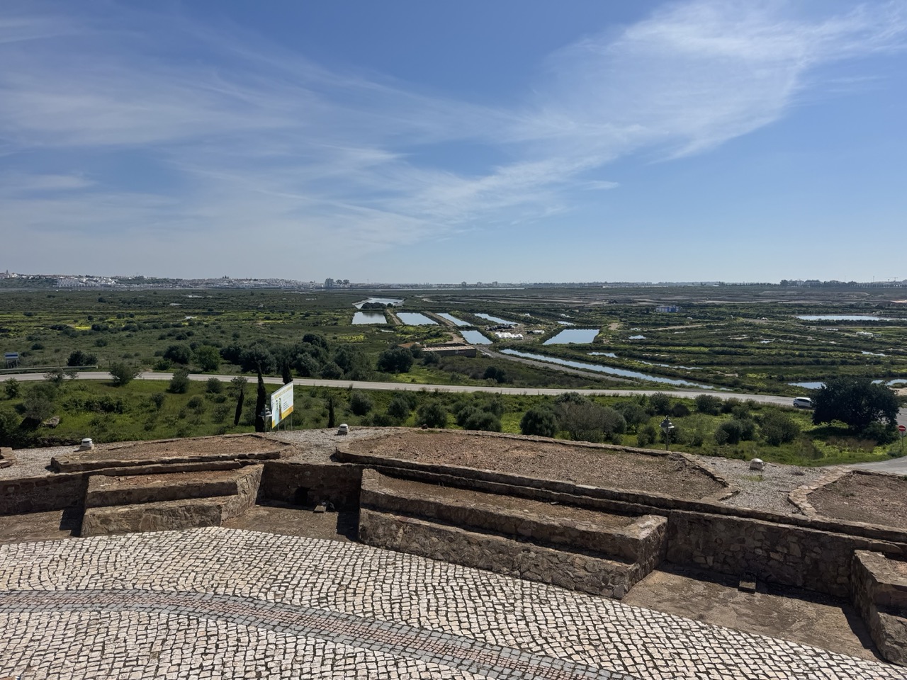
Castro Marim: the castle, the view and the climb that really bites
Raiana fortification dominating strategic Guadiana passage point
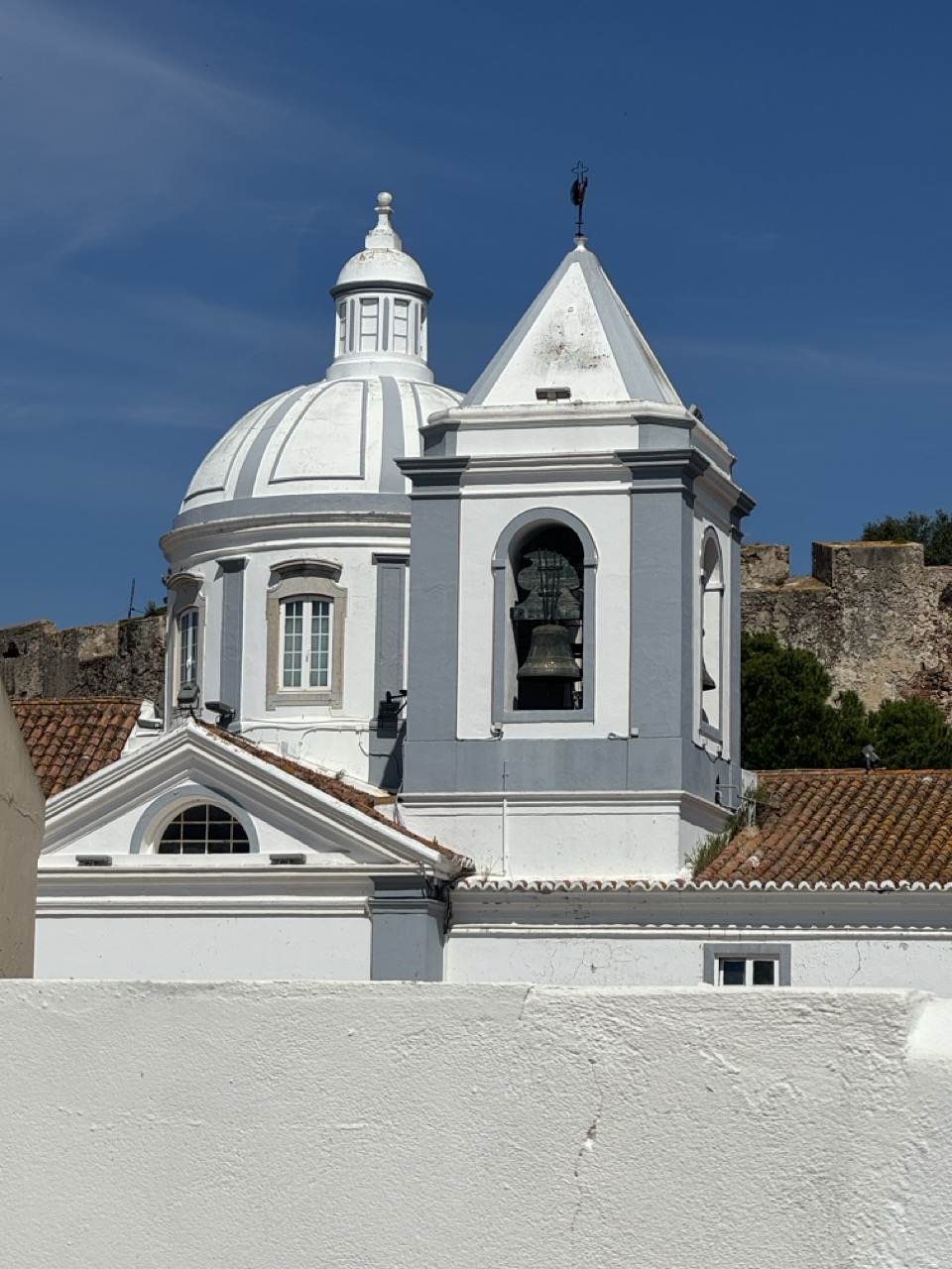
Next, you head towards Castro Marim, a frontier fortification historically positioned dominantly on a key Guadiana crossing point, directly facing Spanish Ayamonte, perfectly visible across the river. In fact, the castle, classified as Monumento Nacional since 1910, constitutes a genuine cultural landmark marking the middle of your gravel ride.

Thus, you park the bike, climb on foot towards the ramparts, and then take in the spectacular panoramic view over the international river, the geometric sapal extending endlessly, the sparkling salt flats, and the Atlantic coastline on the horizon. You therefore understand instantly in a single glance why this strategic site counted so crucially in the complex local frontier history.
Brutal transition postcard to burning legs: However, when you remount, you immediately feel the passage from contemplative observation to real physical effort. Indeed, visitors describe castle access as a genuinely demanding steep cobbled climb. This is exactly the kind of short but intense segment that awakens the legs and adds a welcome sporting dimension to the cultural day.
Consequently, this contrast precisely defines this region's gravel appeal: permanent alternation between, on one hand, fluid horizontal rolling on embankments and compacted paths, and on the other hand, short punchy segments around perched villages simultaneously offering physical challenges and spectacular panoramic visual rewards.
Hinterland: opening terrain, extending the ride, rolling "big space"
Infinite modularity according to daily desires and objectives
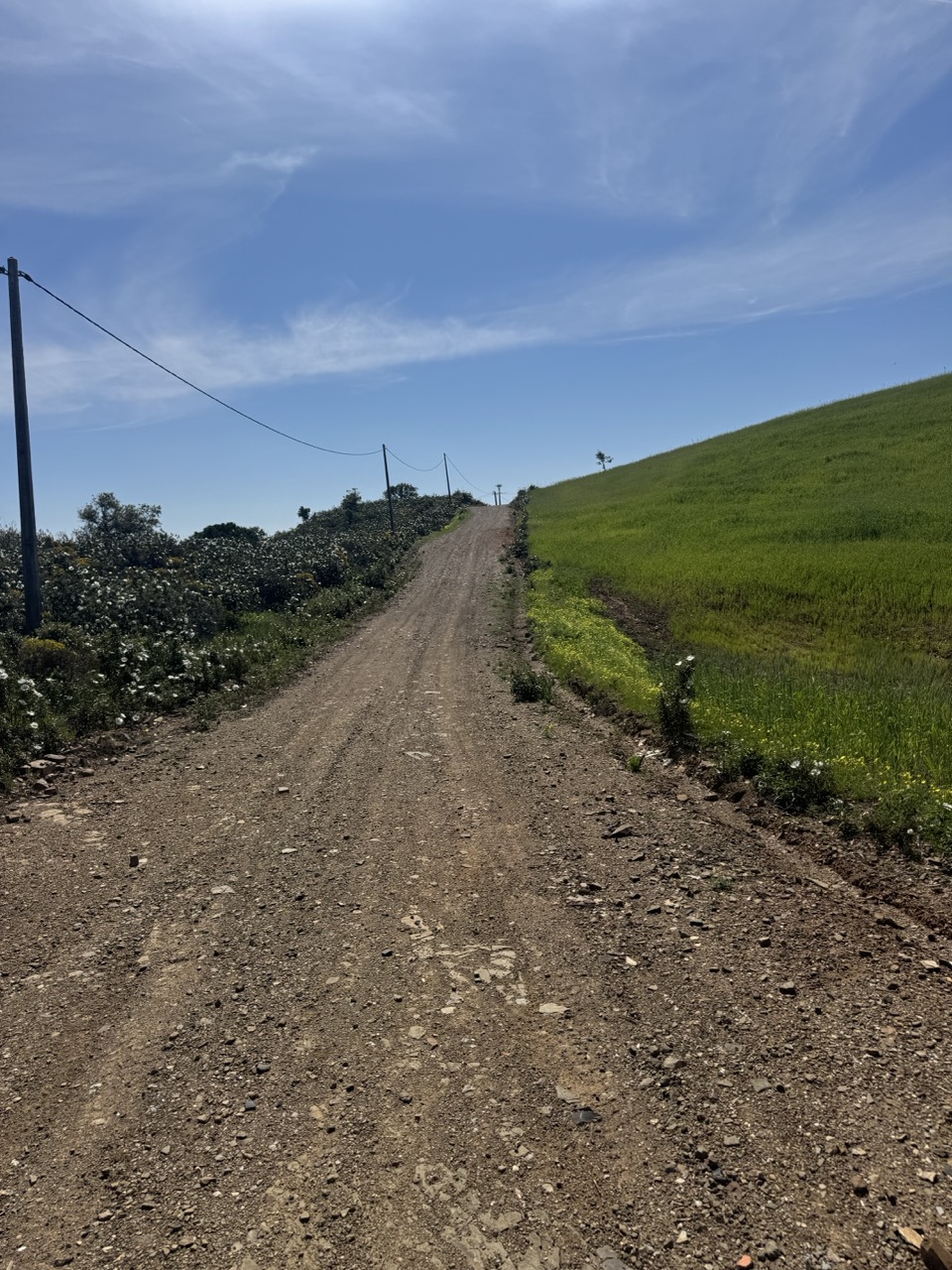
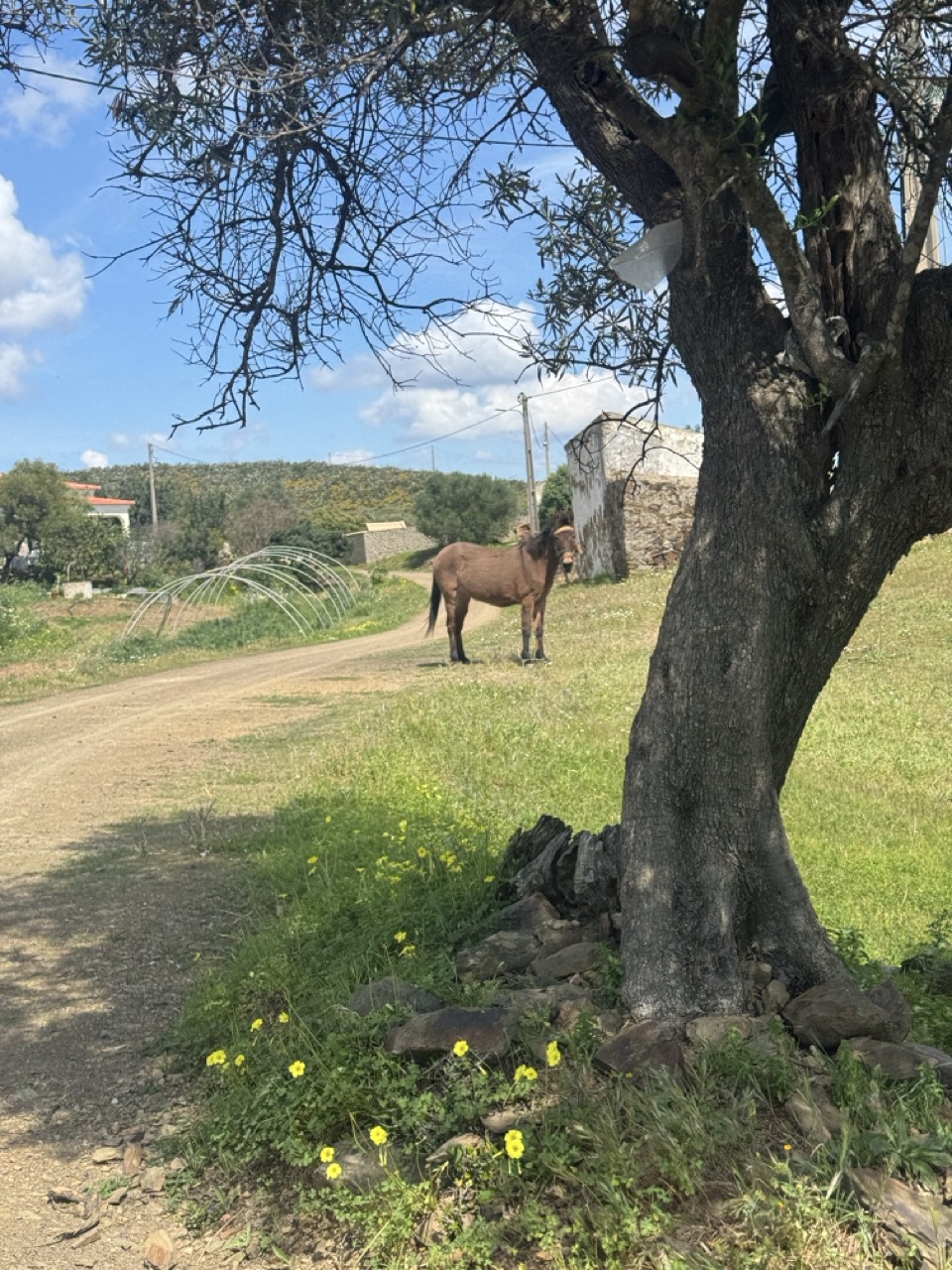
In reality, regional cartography clearly reveals the sector's strategic interest. On one hand, you can leave the tourist coastal axis and, on the other hand, venture deeply into a hinterland where you quickly pass from estuarine wetlands to rural secondary roads and paths. This configuration is therefore ideal for a gravel day intelligently alternating kilometric yield and spontaneous cultural exploration.
Moreover, the Sapal, by its considerable extent, remains the natural geographic backbone of the sector. Indeed, ICNF (Institute for Nature Conservation and Forests) precisely describes this large ecological complex around the Guadiana estuary as an exceptional wetland deserving rigorous protection.
The Baroudeur promise here is simple: first, you ride far without constantly battling dense automobile traffic, then, you have permanent visual horizon, and finally, you concretely feel that terrain can modulate infinitely at will according to daily desire. Whether faster rolling to accumulate kilometres, slower exploration to discover villages, or even punchier "segments" to test your physical condition.
Thus, this total flexibility represents the very essence of modern gravel: the freedom to adapt experience to momentary sensations rather than blindly following a rigid, predefined GPS trace.
Altura and Praia da Alagoa: dunes, Atlantic and passadiços above the sand
Fragile dune system protected by ecological boardwalks
Progressively returning towards the Atlantic coast, you then reach the Altura and Praia da Alagoa zone, positioned on the long dune system characterising the Sotavento littoral. In fact, Altura, officially created as a municipality only in 1993, articulates between the village near the N125 road and the beach zone of Praia da Alagoa integrated into Baía de Monte Gordo.
Moreover, sources document strong urbanisation over recent decades. Indeed, where you would previously find mainly traditional agricultural operations, natural wetlands and some scattered fishermen's houses, Altura has progressively transformed into a major modern beach resort, thus demonstrating recent Algarve tourist development.
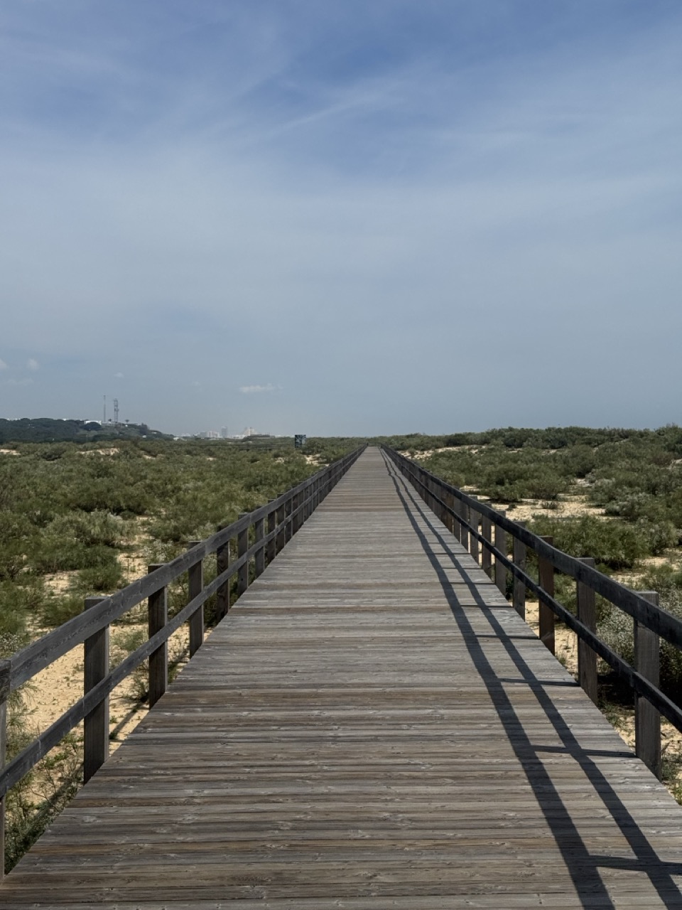
Protective ecological boardwalks: In this regard, the municipality indicates several accesses equipped with elevated passadiços (boardwalks) leading to the beach. These infrastructures therefore permit public access whilst simultaneously protecting the extremely fragile dune ecosystem. This is typically the "contemplative breathing" moment of the gravel day. Thus, you leave the bike secured, walk a few minutes on the elevated wood, breathe the invigorating salt air, look at the fragile vegetated dune, and then concretely understand why these architectural boardwalks exist. They ensure environmental preservation whilst allowing controlled human access.
Ultimately, this pause represents an important psychological transition: the passage from concentrated rolling to restful observation, thus permitting mental recovery before the day's final segments.
Monte Gordo: beachfront atmosphere, restaurants and the great beach passadiço
From fishing village to modern beach resort
Then you naturally glide towards Monte Gordo, whose history is documented as a 19th-century fishing village. Indeed, dozens of fishing families lived directly on the beach from 1820, and even more around 1840, before its progressive transformation into a modern beach resort dramatically accelerating during the 20th century with massive tourism development.
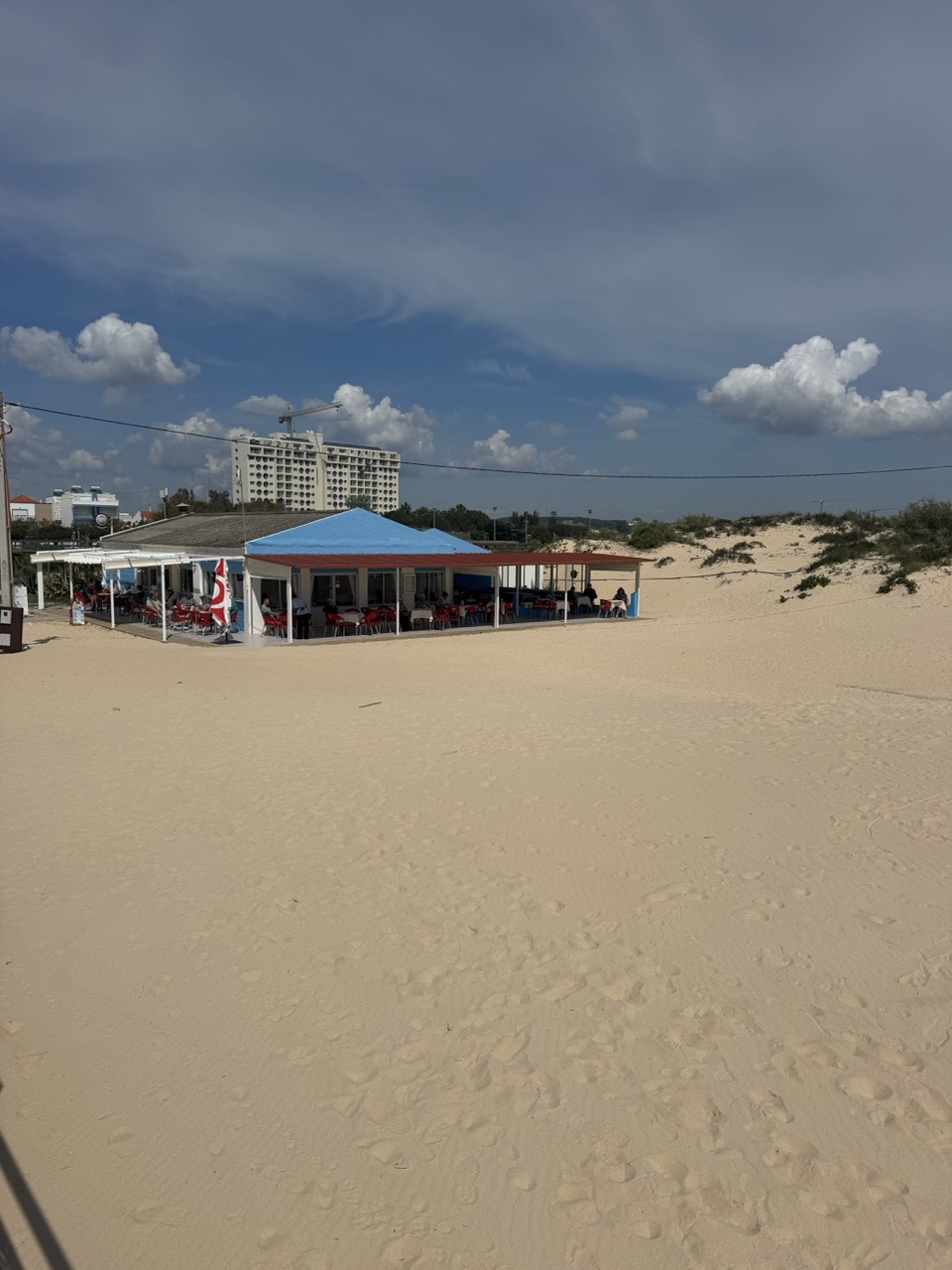
Contemporary infrastructure: There, you then find the atmosphere of a fully functional beach resort. First, an animated seafront, then numerous restaurants, and especially the Praia de Monte Gordo passadiço. This long modern wooden boardwalk is supported by the municipality within the framework of recent urban requalification (official "questions and answers" communication around the project indeed documents the decision-making process).
Consequently, this is an optimal natural spot to recharge energetically (water plus substantial snack), socialise briefly, and observe beach animation before the gravel day's finale. Moreover, this urban section offers welcome contrast with previous hours spent in quasi-deserted natural landscapes.
Alto Rendimento sports centre: Additionally, in immediate proximity, the Complexo Desportivo and Centro de Alto Rendimento de Vila Real de Santo António constitutes a reference centre for professional sports training camps benefiting from practical access from Faro and the Spanish border. Indeed, sources indicate phased development: first, construction beginning in 1977, then the athletics track inaugurated in 1994, and finally, completion of the large covered hall in 2004. This represents a genuine regional asset for cycling trips oriented towards performance, structured training and competitive preparation.
For physical preparation for this type of demanding rides, consult our long-distance ride management guide.
Return via Mata Nacional das Dunas Litorais: coastal pine forest, stabilised dunes, paths everywhere
Spectacular finale through protected dune forest
To finish both strongly physically and magnificently visually, you then return via the Mata Nacional das Dunas Litorais de Vila Real de Santo António. This is described as one of the Algarve coast's best-preserved coastal pine forests, directly associated with fragile dune ecological protection against wind and marine erosion.
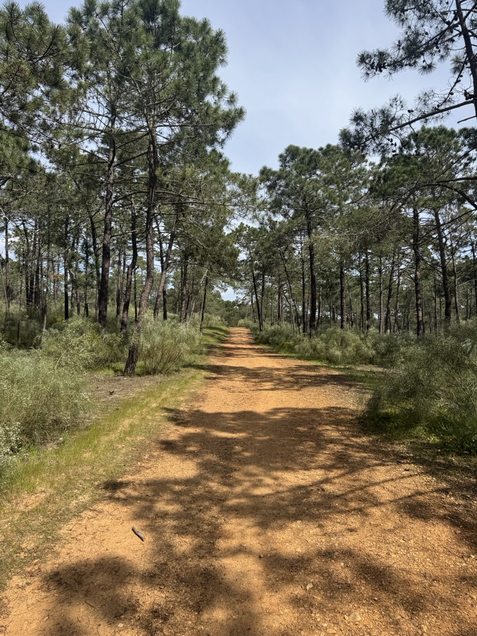
Indeed, the town hall documents a reserve connecting Vila Real to Monte Gordo over several linear kilometres. Thus, you dramatically pass from a water world (the geometric sapal) to a world of umbrella pines and vegetally stabilised sand. This extraordinary landscape transition creates the impression of crossing several different climatic regions in merely a few kilometres.
In gravel, this is an absolutely perfect finale: first, you can ride "immersive nature" on compacted forest paths without breaking cardiovascular rhythm, then, you benefit from the welcome shade of umbrella pines protecting from intense Algarve sun, and finally, you feel that rare sensation of finishing a complete day with a spectacular different landscape rather than a simple functional urban return.
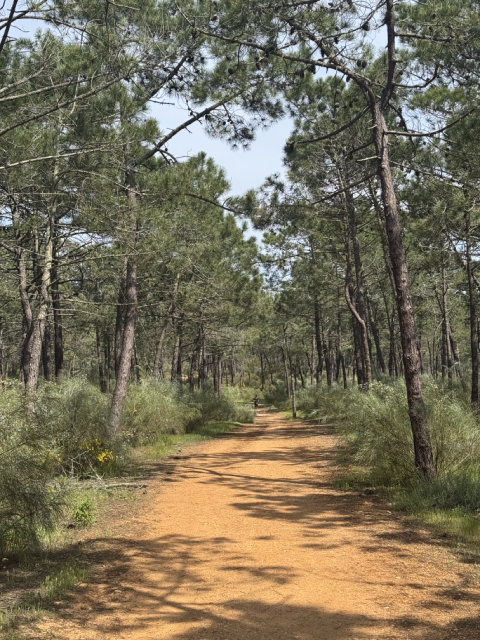
Moreover, the paths here are multiple and interconnected, thus permitting infinite variations and spontaneous discoveries. This is exactly the exploratory gravel spirit sought by cyclists privileging freedom over itinerary rigidity.
Practical logistics: bike rental and coffee break at Café Velo VRSA
Organisational simplicity maximising saddle time
If you want to simplify the day logistically and travel light without your personal bike, you fortunately have a practical point strategically positioned in the town centre. Indeed, Café Velo presents itself as a coffee and brunch spot plus bike rental, with opening announced for "spring 2026," thus perfectly coinciding with the optimal cycling season.
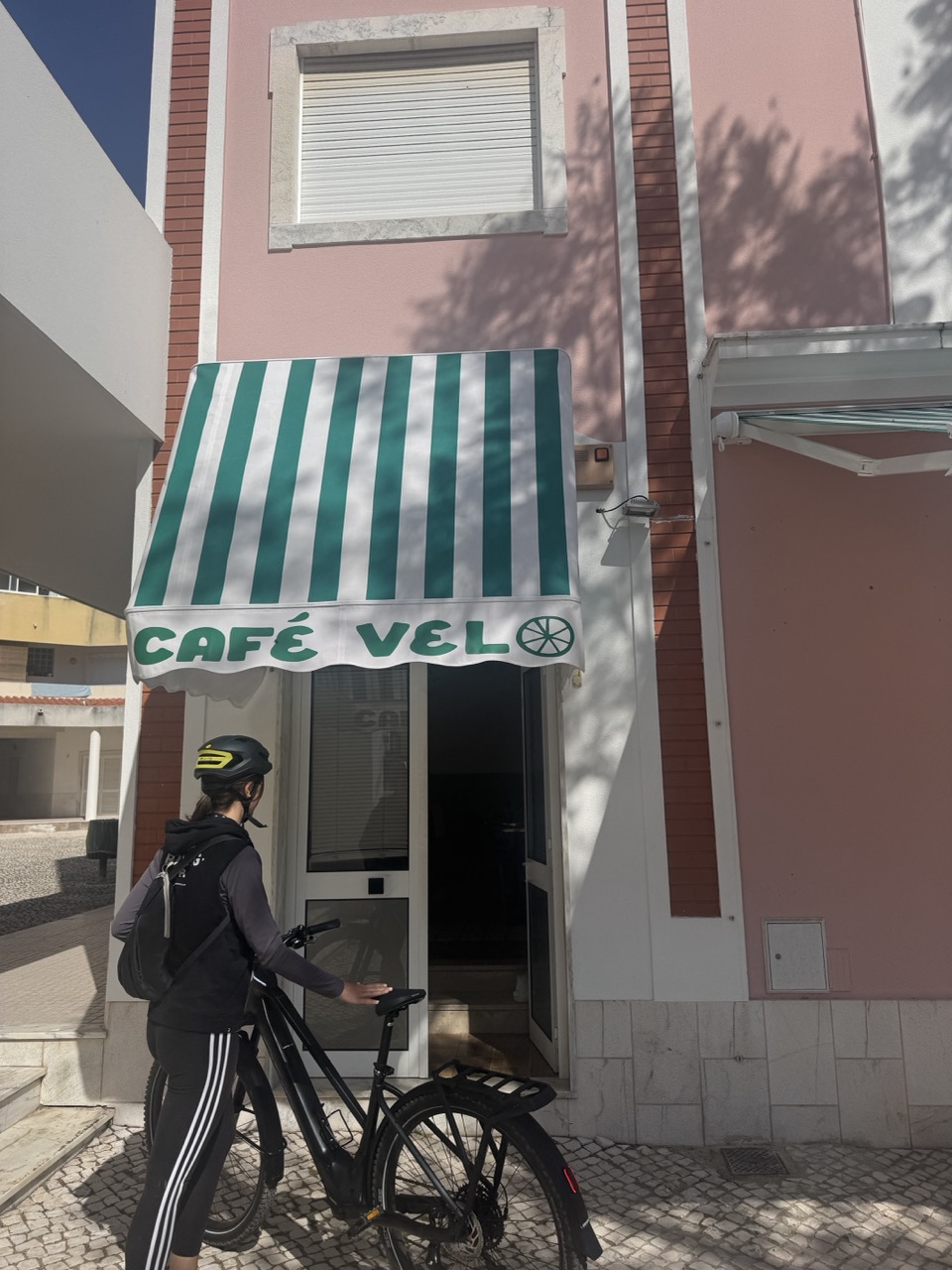
Consequently, for precise details of available bikes (notably e-bikes with electric assistance, frame sizes, and rental conditions), and also for updated kitchen hours, their webpage constitutes the most reliable and current source, thus avoiding unnecessary trips or organisational disappointments.
Ultimately, this local rental option eliminates personal bike air transport complexities whilst simultaneously guaranteeing appropriate equipment perfectly adapted to the specific gravel terrains of eastern Algarve.
Discover Algarve with Baroudeur Cycling
Professionally guided gravel experiences
This gravel day in eastern Algarve perfectly represents the exceptional diversity this region offers cyclists seeking experiences beyond classic tourist beaches. From Pombaline urban heritage to Ramsar international wetlands, from medieval fortified villages to protected coastal pine forests, Sotavento algarvio delivers rare cultural and natural richness.
Our Algarve experiences:
Algarve gravel tour: Star-based format exploring regional terrain diversity from comfortable fixed accommodation.
Essential Algarve routes: Complete guide to the region's best cycling routes.
Portugal cycling holidays: Complete portfolio of Portuguese cycling explorations.
Gravel cycling holidays: Diversified gravel programmes across regions.
velopod : Building a global cycling community from the Algarve
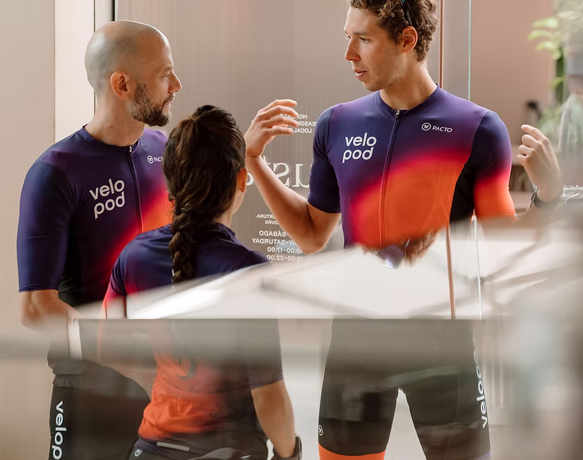
The Algarve has quietly transformed into one of Europe's premier cycling destinations—not through marketing campaigns, but through genuine quality: reliable climate, diverse terrain, and an international community of passionate riders who return year after year.
Yet despite this growth, cyclists still face a familiar frustration: fragmented information. Finding a trusted mechanic, discovering the best local routes, connecting with riding groups, or booking quality accommodation requires piecing together information from dozens of disconnected sources.
Velopod emerges as the solution—a cycling hub for the Algarve designed to centralise everything cyclists need in one intelligent digital environment. And at Baroudeur Cycling, we're contributing what digital platforms can't replicate: tested routes, seamless logistics, professional guidance, and the on-ground expertise that transforms good rides into exceptional experiences.
This isn't simply about listing services—it's about building a structured cycling ecosystem where every element works together, eliminating friction and maximising time on the bike.
Preparation and progression
Gravel riding skills: Developing riding competencies across varied terrains.
Long-distance cycling nutrition: Effort and recovery strategies.
Discovering Sotavento algarvio differently
Eastern Algarve offers a profoundly different gravel experience from the dramatic rocky western coasts. Here, you'll find precisely the contemplative horizontality, geometric water landscapes, frontier cultural heritage, and especially that rare sensation of riding through living functional territories rather than simple tourist scenery.
Indeed, from Pombaline Vila Real de Santo António to protected dune pine forests, successively passing through Ramsar-classified salt marshes and medieval fortified villages, this gravel day reveals the exceptional richness of a region too often ignored by cyclists focused on the more famous western Algarve.
Ready to discover authentic Sotavento algarvio? Don't hesitate to contact us to plan your personalised gravel exploration of eastern Algarve where heritage, nature and cycling freedom meet harmoniously.
Article based on Baroudeur Cycling's terrain exploration of eastern Algarve